Option I: Carrickmines to Poolbeg
Option I : Carrickmines to Poolbeg
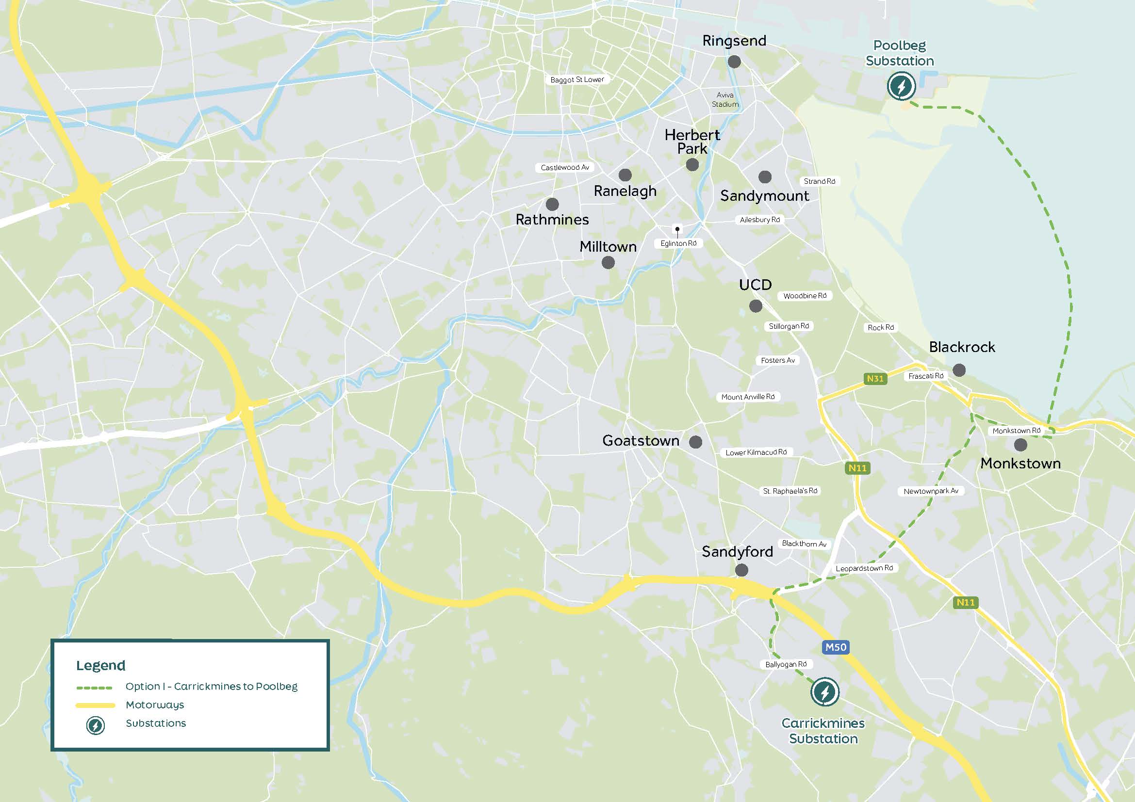
Option I leaves the Carrickmines substation and follows the Ballyogan Road northwest adjacent to the Luas Green Line. It continues into Murphystown Way where it crosses the M50 at Junction 14 on to the N31.
The route crosses under the Luas Green Line at Brewery Road junction (overhead bridge crossing), continues down the Leopardstown Road and crosses Stillorgan Road (N11) before joining Newtownpark Avenue. The route joins the N31 at Temple Hill and proceeds north for a short distance.
At the junction with Monkstown Road, the route turns in an easterly direction and travels through Monkstown Village. At the junction of Monkstown Crescent and Link Road, the route turns north and travels into the Salthill and Monkstown DART station Car Park. From this point, the route becomes a submarine corridor from the Salthill landfall point to the Poolbeg Peninsula landfall point to the north. From the northern landfall, the route travels on to the Poolbeg substation.
Click to zoom and enlarge