Option A - The Red Route
Option A - The Red Route
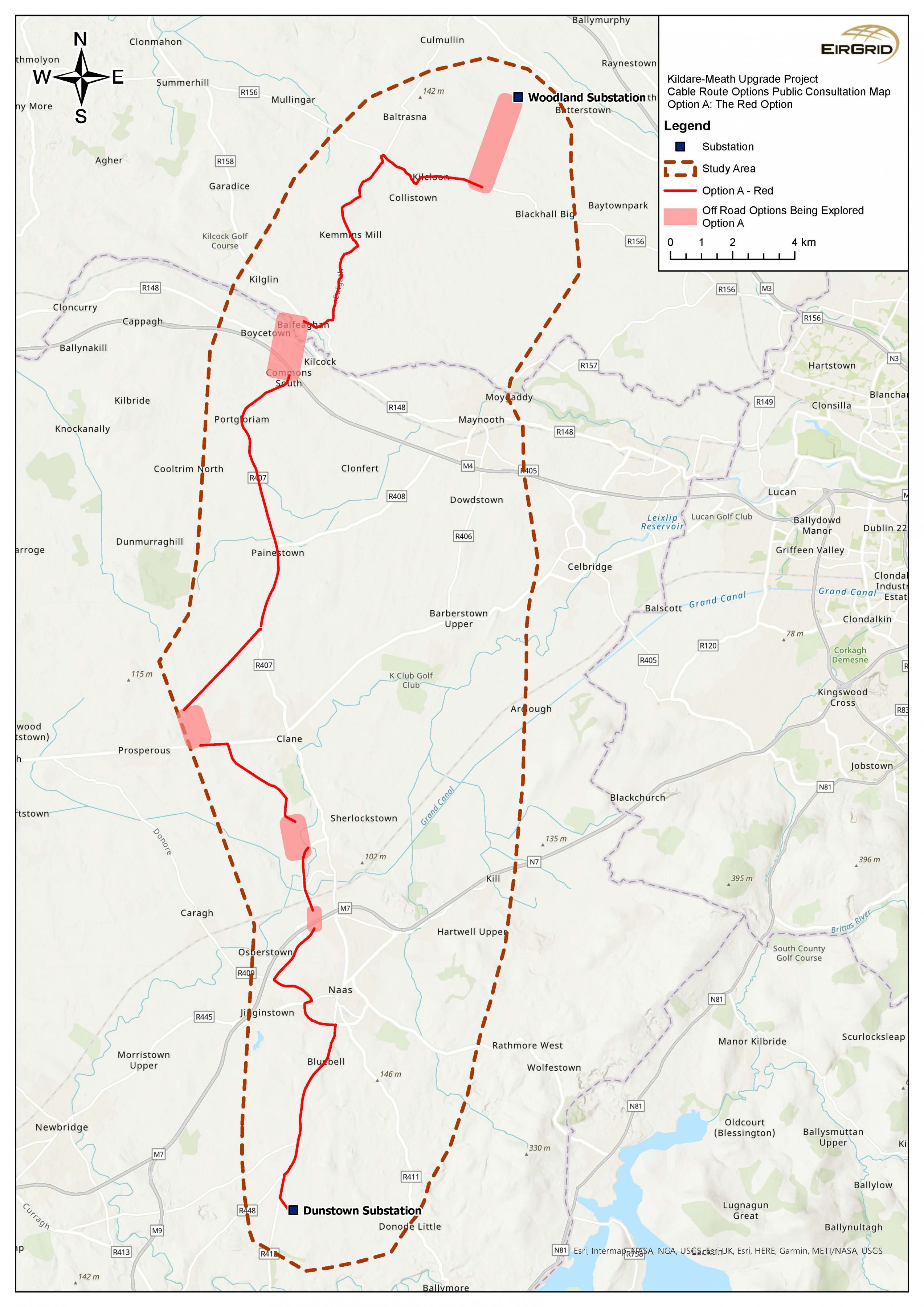
Option A is the most westerly of the shortlisted cable route options and it is potentially the longest.
From Woodland, Option A would travel north west along the R156 towards the Mullagh Crossroads.
It would travel south along the R156, R125, and R158 towards Kilcock. Option A would pass to the west of the village of Kilcock and a potential off-road corridor is shown on the route map.
The route will need to cross:
- the Rye Water,
- the Royal Canal,
- Dublin-Sligo railway line, and
- M4 Motorway.
To the south of Kilcock, Option A is proposed to travel to the south along the R407 towards Clane.
To the north of Clane at the Boherhole Crossroads, it is proposed to take Option A to the west to avoid Clane.
Option A will travel along the R408, the road to Prosperous. Close to the townland of The Cott, it is proposed to route the cable across agricultural land to the south east of the R408 so that the route can continue to travel to the south towards the Dunstown substation.
Option A will travel south along the R403 and the L2002 to the new Sallins Bypass where a potential off-road corridor is shown for a crossing of agricultural land.
Along the Sallins Bypass, Option A will cross:
- the River Liffey,
- Dublin-Cork (and others) railway line,
- the Grand Canal, and
- the M7 Motorway (potential off-road corridor).
After crossing under the M7 Motorway, Option A will travel along the Millennium Link Road, travelling to the west around Naas.
Option A will connect with the R409 and travel east towards Naas, passing the Naas Sports Centre and across the Grand Canal.
The cable route then travels along the R445 and the R447 (South Ring Road).
Option A connects with the R448 (Kilcullen Road) and then travels into the Dunstown substation.
Figure 4: Option A: The Red Option
Click to enlarge and zoom
Interactive Map: Option A - The Red Option
